Napier WV Land for Sale
$499,500
0 Little Knawl Road Napier, WV 26631
- Type:
- Land
- Sq.Ft.:
- n/a
- Status:
- Active
- Beds:
- n/a
- Lot size:
- 312.62 Acres
- Baths:
- MLS#:
- 179945
ADDITIONAL INFORMATION
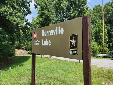
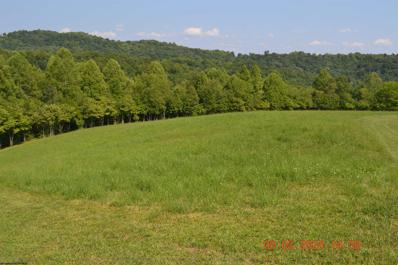
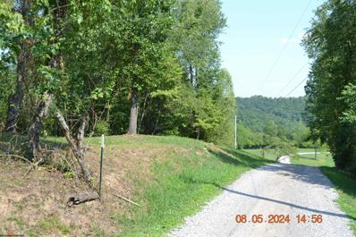
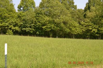
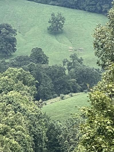
Contiguous three hundred -twelve acre +/- acre multi-use parcel in the heart of a recreational powerhouse in the geographical center of West Virginia Ten minutes to the nine hundred eighty-nine-acre Burnsville Lake Adjoins the 12,579-acre Burnsville Lake WMA for one and a half miles Free natural gas available for residential use Recreation at Burnsville Lake Forest offers outstanding onsite recreational opportunities The property has many ridges, several major hollows, ½ mile long blueline stream, and several ephemeral creeks creating a diverse and interesting topography Superb regional recreational opportunities Ten rivers and six lakes are within an easy ten minutes to two hour drive A blue line mountain stream flows through the property for 4/10 mile Miles of internal forest management roads, plus miles of forest trails, offer excellent access to a large portion of the forest Perfect for shooting sports, ATV riding, horseback riding, hiking, camping, hunting and nature viewing The town of Flatwoods is a 20-minute drive High percentage of commercially â?? operable ground supporting forestry, recreation and potential for numerous future cabin sites Elevations range from 2147 ft. to 2455 ft. +/- Potential conservation value Low taxes, low population density, little or no light pollution Great fishing is found in the Heartlandâ??s region with ten rivers and six lakes. Species include small and large mouth bass, crappie, catfish, muskie, walleye, pike and bluegill The rivers and lakes are ideal for swimming, canoeing, fishing, kayaking, tubing, snorkeling, paddle boarding and windsurfing Forest is a steady producer of life-giving Oxygen and silently works to sequester carbon Several decades of professional forest and wildlife management As the trees continue to grow, there will be very valuable hardwood timber available to harvest Jet airports less than a sixty-minute drive Potential for leasing carbon credits LOCATION Google Coordinates: 38.810494°(N), -80.551211°(W) Address: Little Knawl Road, Napier, WV 26631. No 911 address is assigned to property without structures. Elevation Range: 868 ft. to 1487 ft. +/- Driving Times Highways/Towns I-79 at Flatwoods Exit 67: 30 minutes I-79 at Burnsville-Glenville Exit 79: 30 Minutes Buchannon: 55 minutes Burnsville: 30 minutes Clarksburg: 1 hour 10 minutes Elkins: 1 hour 15 minutes Flatwoods: 30 minutes Glenville & Glenville State University: 55 minutes Summersville: 1 hour Weston: 50 minutes Airports Braxton County Airport (small), Sutton: 30 minutes Elkins-Randolph County Regional Airport: 1 hour 30 minutes Upshur County Regional Airport, Buchannon: 55 minutes Recreation Burnsville Lake Wildlife Management Area: 5 minutes Elk River Wildlife Management Area, Sutton: 50 minutes Golf Course, Stonewall Jackson Resort: 40 minutes Lake â?? Burnsville Lake â?? Bulltown Campground and boat ramp: 10 minutes Lake â?? Sutton Lake: 35 minutes Lake â?? Stonewall Jackson Lake & Resort: 40 minutes Lake â?? Summersville Lake: 1 hour 10 minutes Google Coordinates: 38.810494 (N), -80.551211 (W) on road in front of camper spot WATER A dashed blueline branch (intermittent water flow) of Little Knawl Creek begins on the property and travels on the property for about ½ mile. Little Knawl Creek, a blueline stream, is on the property periodically as it travels along the road and property boundary. The streams should have regular water flow, especially during snow melt and rain events. MINERAL RESOURCES West Virginia is one of the states in the US that has two ownership titles, those being SURFACE RIGHTS and MINERAL RIGHTS. This is a SURFACE ONLY conveyance as the mineral rights have been reserved in the ownerâ??s deed. BOUNDARIES AND SURVEY Directly joins the Burnsville Lake Wildlife Management Area for about one and a quarter miles. The property is being sold by the boundary and not by the acre.
- Type:
- Land
- Sq.Ft.:
- n/a
- Status:
- Active
- Beds:
- n/a
- Lot size:
- 2.79 Acres
- Baths:
- MLS#:
- 10155690
ADDITIONAL INFORMATION
- Type:
- Land
- Sq.Ft.:
- n/a
- Status:
- Active
- Beds:
- n/a
- Lot size:
- 2.55 Acres
- Baths:
- MLS#:
- 10155689
ADDITIONAL INFORMATION
- Type:
- Land
- Sq.Ft.:
- n/a
- Status:
- Active
- Beds:
- n/a
- Lot size:
- 4.68 Acres
- Baths:
- MLS#:
- 10155688
ADDITIONAL INFORMATION
$550,000
County Rte 19/12 Napier, WV 26631
- Type:
- Land
- Sq.Ft.:
- n/a
- Status:
- Active
- Beds:
- n/a
- Lot size:
- 91.09 Acres
- Baths:
- MLS#:
- 23-1034
ADDITIONAL INFORMATION
This property consisting of 91.09 acres is very unique and offers so many possibilities. There are several building sites to build your dream home having extending views of the valley below. Electric is in place. City water is available to property bordering Millstone Run Road. Plenty of acreage to give you privacy and explore the outdoors. Property is located next to the Burnsville Campground and Lake where you can take advantage of numerous recreation opportunities, including hunting. Boat rentals and storage are available at the marina. Tour Bulltown Historical Village to get a taste of pioneer life during the Civil War Era. The opposite side of this property borders Mtn. Valley Pipeline. Don't miss out! Use your imagination and own a piece of Almost Heaven West Virginia!
The listing content relating to real estate for sale on this web site comes in part from the IDX Program of the North Central West Virginia Real Estate Information Network and is provided exclusively for consumers’ personal, non-commercial use, that it may not be used for any purpose other than to identify prospective properties consumers may be interested in purchasing. Copyright 2025 North Central West Virginia REIN. All rights reserved. Information is deemed reliable but is not guaranteed

Napier Real Estate
The median home value in Napier, WV is $166,000. This is higher than the county median home value of $120,800. The national median home value is $338,100. The average price of homes sold in Napier, WV is $166,000. Approximately 43.56% of Napier homes are owned, compared to 0% rented, while 56.44% are vacant. Napier real estate listings include condos, townhomes, and single family homes for sale. Commercial properties are also available. If you see a property you’re interested in, contact a Napier real estate agent to arrange a tour today!
Napier, West Virginia 26631 has a population of 459. Napier 26631 is less family-centric than the surrounding county with 0% of the households containing married families with children. The county average for households married with children is 27.97%.
The median household income for the surrounding county is $42,519 compared to the national median of $69,021. The median age of people living in Napier 26631 is 35.7 years.
Napier Weather
The average high temperature in July is 84.7 degrees, with an average low temperature in January of 21.3 degrees. The average rainfall is approximately 48.3 inches per year, with 21 inches of snow per year.
