Brentwood NH Land for Sale
$1,500,000
0 Pine Road Brentwood, NH 03833
- Type:
- Land
- Sq.Ft.:
- n/a
- Status:
- Active
- Beds:
- n/a
- Lot size:
- 95 Acres
- Baths:
- MLS#:
- 4981823
ADDITIONAL INFORMATION
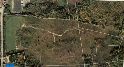
Commercial/Industrial Land - +/- 95 acres of Commercial/Industrial zoned land with +/- 80 acres in Brentwood and +/- 15 acres in Exeter. 1,345 foot frontage on Pine Road. Current Use fee to be paid by the Buyer.
$699,900
316 South Road Brentwood, NH 03833
- Type:
- Land
- Sq.Ft.:
- n/a
- Status:
- Active
- Beds:
- n/a
- Lot size:
- 7.03 Acres
- Baths:
- MLS#:
- 73102902
ADDITIONAL INFORMATION
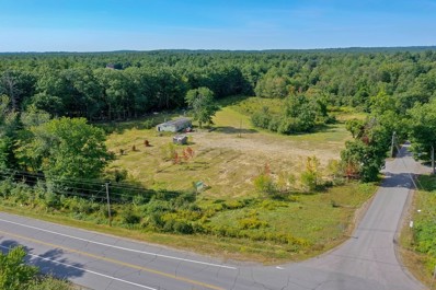
At the corner of South Road and Route 125 with over 600' frontage on Route 125 is 7 acres of level, mostly cleared land recently used as a garden center. There is a 1400 sf circa 1970 mobile home on the site with drilled well and septic. Brentwood's Commercial -Industrial district has a number of permitted uses. This property is adjacent to the Rockingham County Courthouse property near the Kingston Town Line in a growing commercial area. (A 900,000sf distribution facility was just approved by the Town of Kingston for the parcel two properties south of this land.)

Copyright 2024 PrimeMLS, Inc. All rights reserved. This information is deemed reliable, but not guaranteed. The data relating to real estate displayed on this display comes in part from the IDX Program of PrimeMLS. The information being provided is for consumers’ personal, non-commercial use and may not be used for any purpose other than to identify prospective properties consumers may be interested in purchasing. Data last updated {{last updated}}.

The property listing data and information, or the Images, set forth herein were provided to MLS Property Information Network, Inc. from third party sources, including sellers, lessors and public records, and were compiled by MLS Property Information Network, Inc. The property listing data and information, and the Images, are for the personal, non-commercial use of consumers having a good faith interest in purchasing or leasing listed properties of the type displayed to them and may not be used for any purpose other than to identify prospective properties which such consumers may have a good faith interest in purchasing or leasing. MLS Property Information Network, Inc. and its subscribers disclaim any and all representations and warranties as to the accuracy of the property listing data and information, or as to the accuracy of any of the Images, set forth herein. Copyright © 2024 MLS Property Information Network, Inc. All rights reserved.
Brentwood Real Estate
The median home value in Brentwood, NH is $729,921. This is higher than the county median home value of $492,900. The national median home value is $338,100. The average price of homes sold in Brentwood, NH is $729,921. Approximately 89.06% of Brentwood homes are owned, compared to 5.82% rented, while 5.12% are vacant. Brentwood real estate listings include condos, townhomes, and single family homes for sale. Commercial properties are also available. If you see a property you’re interested in, contact a Brentwood real estate agent to arrange a tour today!
Brentwood, New Hampshire has a population of 4,503. Brentwood is more family-centric than the surrounding county with 47.38% of the households containing married families with children. The county average for households married with children is 30.7%.
The median household income in Brentwood, New Hampshire is $148,281. The median household income for the surrounding county is $101,683 compared to the national median of $69,021. The median age of people living in Brentwood is 43.1 years.
Brentwood Weather
The average high temperature in July is 81.5 degrees, with an average low temperature in January of 13 degrees. The average rainfall is approximately 49.7 inches per year, with 55.7 inches of snow per year.

