Gibson IA Homes for Sale
$1,365,323
110th Ave. Thornburg, IA 50104
- Type:
- Farm
- Sq.Ft.:
- n/a
- Status:
- Active
- Beds:
- n/a
- Lot size:
- 152.55 Acres
- Baths:
- MLS#:
- 2407400
ADDITIONAL INFORMATION
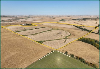
This is a productive 152.55-acre Keokuk County farm with a 63.2 CSR2 on 138.32 acres of cropland. Primary soils are Colo, Gara-Armstrong and Otley.
$1,365,323
110th Ave. At 110th St. Gibson, IA 50104
- Type:
- Farm
- Sq.Ft.:
- n/a
- Status:
- Active
- Beds:
- n/a
- Lot size:
- 152.55 Acres
- Baths:
- MLS#:
- 6322379
- Subdivision:
- IA
ADDITIONAL INFORMATION
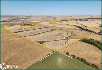
152.55 acres, m/l, located 1 mile north of Gibson, Iowa on the east side of 110th Ave. This gently rolling to rolling farm has an estimated 138.32 FSA/Eff. crop acres with a CSR2 of 63.20. This is a productive Keokuk County farm.
Information is provided exclusively for consumers personal, non - commercial use and may not be used for any purpose other than to identify prospective properties consumers may be interested in purchasing. Copyright 2024 , Cedar Rapids Area Association of Realtors
Albert Wright Page, License B62241000, Xome Inc., License FO5635000, [email protected], 844-400-XOME (9663), 4471 North Billman Estates, Shelbyville, IN 46176

Listings courtesy of NoCoast MLS as distributed by MLS GRID. Based on information submitted to the MLS GRID as of {{last updated}}. All data is obtained from various sources and may not have been verified by broker or MLS GRID. Supplied Open House Information is subject to change without notice. All information should be independently reviewed and verified for accuracy. Properties may or may not be listed by the office/agent presenting the information. Properties displayed may be listed or sold by various participants in the MLS.
Gibson Real Estate
The median home value in Gibson, IA is $75,200. This is lower than the county median home value of $116,000. The national median home value is $338,100. The average price of homes sold in Gibson, IA is $75,200. Approximately 80.77% of Gibson homes are owned, compared to 15.39% rented, while 3.85% are vacant. Gibson real estate listings include condos, townhomes, and single family homes for sale. Commercial properties are also available. If you see a property you’re interested in, contact a Gibson real estate agent to arrange a tour today!
Gibson, Iowa 50104 has a population of 35. Gibson 50104 is more family-centric than the surrounding county with 31.82% of the households containing married families with children. The county average for households married with children is 28.42%.
The median household income in Gibson, Iowa 50104 is $46,094. The median household income for the surrounding county is $54,233 compared to the national median of $69,021. The median age of people living in Gibson 50104 is 59.3 years.
Gibson Weather
The average high temperature in July is 84.4 degrees, with an average low temperature in January of 11.2 degrees. The average rainfall is approximately 36.8 inches per year, with 28.1 inches of snow per year.

