Muncie IN Homes for Rent
- Type:
- Land
- Sq.Ft.:
- n/a
- Status:
- Active
- Beds:
- n/a
- Lot size:
- 56.88 Acres
- Baths:
- MLS#:
- 202319154
- Subdivision:
- Other
ADDITIONAL INFORMATION
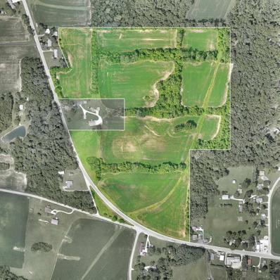
56.88 acres zoned farming. Approximately 54 acres tillable. Crops belong to current tenant. Total of 4 parcels - will not be divided. Fourth parcel number is 18-16-19-227-001.000-020. For directional purposes: this acreage is North & South of 1100 S. US 35 which is a 4 acre parcel with house & barn, etc. owned by neighbor & not included in the sale. Also, not included in the 56.88 acres is 1.35 acres south of highway 35 which will be separated at closing). Seller will consider a contract sale for qualified buyer.
$197,000
S Meeker Avenue Muncie, IN 47302
- Type:
- Land
- Sq.Ft.:
- n/a
- Status:
- Active
- Beds:
- n/a
- Lot size:
- 6.6 Acres
- Baths:
- MLS#:
- 202314109
- Subdivision:
- None
ADDITIONAL INFORMATION
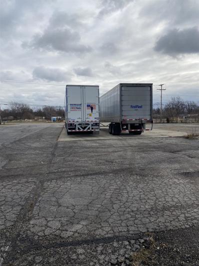
6.6 acre Intense Industrial zoned parcel on South Meeker Ave. This is the former Duffy Tool and Stamping parking lot site and the majority of the site is grass with 1-2 acres of asphalt and concrete. Partially fenced. There are another 2 parcels owned by the same seller and if still available can be purchased as a package. 1) A 1.3 acre parcel zoned R2 located adjacent to the north 2) a 3.88 acre parcel across Meeker to the east.
- Type:
- Land
- Sq.Ft.:
- n/a
- Status:
- Active
- Beds:
- n/a
- Lot size:
- 3.88 Acres
- Baths:
- MLS#:
- 202314103
- Subdivision:
- None
ADDITIONAL INFORMATION
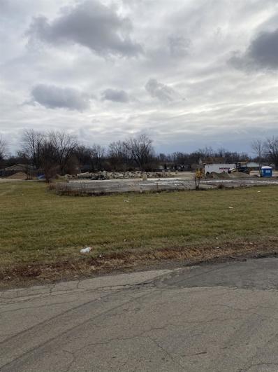
3.88 acre Intense Industrial Zoned parcel on South Meeker. This is the former Duffy Tool and Stamping site and the majority of the site is covered with concrete or asphalt. A 6.6 acre parcel zoned Intense Industrial and a 1.3 acre parcel zoned R2 located across Meeker to the west are also offered for sale by the same owner. Each of these 3 parcels can be purchased separately or as a package subject to availability.
$45,000
Meeker Avenue Muncie, IN 47302
- Type:
- Land
- Sq.Ft.:
- n/a
- Status:
- Active
- Beds:
- n/a
- Lot size:
- 1.3 Acres
- Baths:
- MLS#:
- 202314100
- Subdivision:
- None
ADDITIONAL INFORMATION
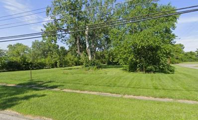
1.3 acre grass lot on South Meeker. Adjacent properties include a church to the north and a 6.6 acre parcel zoned Intense Industrial to the south. This parcel is one of three parcels in this area that can be purchased separately or can be included as a package with the 6.6 acre parcel to the south and a 3.88 parcel across Meeker to the east.
$1,880,000
900 W Fuson Road Muncie, IN 47302
- Type:
- General Commercial
- Sq.Ft.:
- n/a
- Status:
- Active
- Beds:
- n/a
- Lot size:
- 80 Acres
- Year built:
- 1900
- Baths:
- MLS#:
- 202321182
- Subdivision:
- None
ADDITIONAL INFORMATION
Industrial Park zoned 80 acres with rail access. This site is level and ready for development. Currently used as agricultural land. 1300+/- feet of frontage on Fuson Rd. Easy access to Start Road 67 for access to Interstate 69. Industrial users, Magna Powertrain adjacent to the west and Progress Rail, (A Caterpillar Company) to the north. New 800,000 + sq ft CanPak plant 1/4 mile west.
$300,000
W Hessler Road Muncie, IN 47304
- Type:
- Land
- Sq.Ft.:
- n/a
- Status:
- Active
- Beds:
- n/a
- Lot size:
- 0.95 Acres
- Baths:
- MLS#:
- 202304259
- Subdivision:
- None
ADDITIONAL INFORMATION
Building site, great location just off North Morrison Road, lot contains .95 acre, price substantially reduced. Located just north of the Village Pantry on Morrison Road, close to American Health Network, WalMart, Lowes and Pet Smart. **Refer to Article 30 Section 7 of the Muncie Zoning Ordinance on new construction
$400,000
N Morrison Road Muncie, IN 47304
- Type:
- Land
- Sq.Ft.:
- n/a
- Status:
- Active
- Beds:
- n/a
- Lot size:
- 1.9 Acres
- Baths:
- MLS#:
- 202304261
- Subdivision:
- None
ADDITIONAL INFORMATION
Great building site located just north of SR 332 just north of Bethel Avenue on Morrison Road. Close to American Health Network, Pet Smart, Lowes and Walmart. Property is zoned variety business and contains approximately 1.88 acres. Zoned variety business.

Information is provided exclusively for consumers' personal, non-commercial use and may not be used for any purpose other than to identify prospective properties consumers may be interested in purchasing. IDX information provided by the Indiana Regional MLS. Copyright 2025 Indiana Regional MLS. All rights reserved.
Muncie Real Estate
The median home value in Muncie, IN is $152,000. This is higher than the county median home value of $129,900. The national median home value is $338,100. The average price of homes sold in Muncie, IN is $152,000. Approximately 41.87% of Muncie homes are owned, compared to 43.25% rented, while 14.88% are vacant. Muncie real estate listings include condos, townhomes, and single family homes for sale. Commercial properties are also available. If you see a property you’re interested in, contact a Muncie real estate agent to arrange a tour today!
Muncie, Indiana has a population of 65,571. Muncie is less family-centric than the surrounding county with 19.71% of the households containing married families with children. The county average for households married with children is 24.29%.
The median household income in Muncie, Indiana is $36,661. The median household income for the surrounding county is $49,321 compared to the national median of $69,021. The median age of people living in Muncie is 28.6 years.
Muncie Weather
The average high temperature in July is 84 degrees, with an average low temperature in January of 18.2 degrees. The average rainfall is approximately 40.4 inches per year, with 22.3 inches of snow per year.
