Sherwood OH Land for Sale
- Type:
- Land
- Sq.Ft.:
- n/a
- Status:
- Active
- Beds:
- n/a
- Lot size:
- 5.01 Acres
- Baths:
- MLS#:
- 6095885
ADDITIONAL INFORMATION
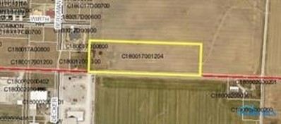
Commercial lots on Defiance County Parcel C180017001204, on State Route 18 east of Rt 127. 4 lots of .9 acres and the east lot of 1 acres or more.
ADDITIONAL INFORMATION
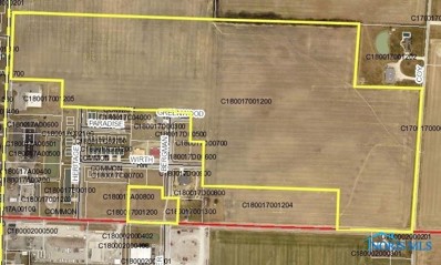
Commercial lot on Defiance County Parcel C180017001200, on State Route 127, just north of Dollar General, 1 acre in size. Size negotiable. Taxes will be reassessed after split.
ADDITIONAL INFORMATION
Residential lot on Defiance County Parcel C180017001200, at the the North West corner of State Route 18 and Coy Road, approximately 1 acre, size negotiable. Taxes will be reassessed after split.

Sherwood Real Estate
The median home value in Sherwood, OH is $135,600. This is lower than the county median home value of $152,600. The national median home value is $338,100. The average price of homes sold in Sherwood, OH is $135,600. Approximately 64.77% of Sherwood homes are owned, compared to 24.5% rented, while 10.74% are vacant. Sherwood real estate listings include condos, townhomes, and single family homes for sale. Commercial properties are also available. If you see a property you’re interested in, contact a Sherwood real estate agent to arrange a tour today!
Sherwood, Ohio 43556 has a population of 789. Sherwood 43556 is more family-centric than the surrounding county with 43.15% of the households containing married families with children. The county average for households married with children is 26.09%.
The median household income in Sherwood, Ohio 43556 is $61,563. The median household income for the surrounding county is $65,779 compared to the national median of $69,021. The median age of people living in Sherwood 43556 is 34.6 years.
Sherwood Weather
The average high temperature in July is 84.3 degrees, with an average low temperature in January of 17.2 degrees. The average rainfall is approximately 35.3 inches per year, with 25.3 inches of snow per year.


