Cantil CA Land for Sale
- Type:
- Land
- Sq.Ft.:
- n/a
- Status:
- Active
- Beds:
- n/a
- Lot size:
- 2.51 Acres
- Baths:
- MLS#:
- EV24079766
ADDITIONAL INFORMATION
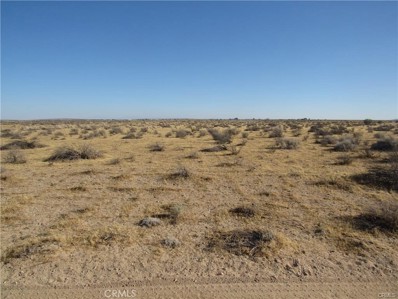
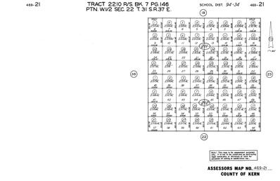
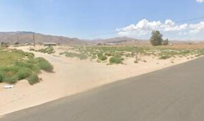
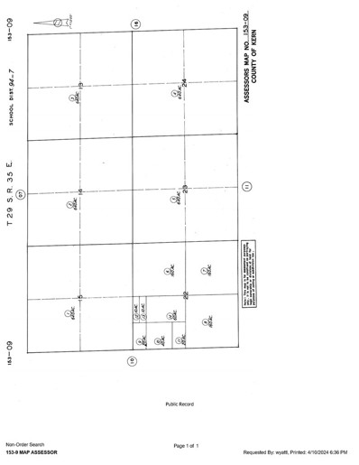
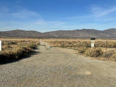
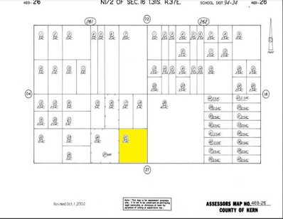
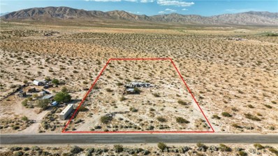
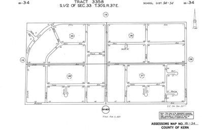
There is not an address associated with this parcel. What is reflected is the Parcel# of 469-212-19-00-8 which is +/- 2.51 AC. Zoning is PL RS MH. Located in the area of Cantil which is Unincorporated Kern County.
- Type:
- Land
- Sq.Ft.:
- n/a
- Status:
- Active
- Beds:
- n/a
- Lot size:
- 2.51 Acres
- Baths:
- MLS#:
- 24002940
ADDITIONAL INFORMATION
There is not an address associated with this parcel. What is reflected is the Parcel# of 469-212-19-00-8 which is +/- 2.51 AC. Zoning is PL RS MH. Located in the area of Cantil which is Unincorporated Kern County.
- Type:
- Land
- Sq.Ft.:
- n/a
- Status:
- Active
- Beds:
- n/a
- Lot size:
- 2.51 Acres
- Baths:
- MLS#:
- 24002939
ADDITIONAL INFORMATION
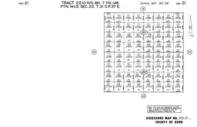
There is not an address associated with this parcel. What is reflected is the Parcel# of 469-211-08-00-9 which is +/- 2.51 AC. Zoning is PL RS MH. Located in the area of Cantil which is Unincorporated Kern County.
- Type:
- Land
- Sq.Ft.:
- n/a
- Status:
- Active
- Beds:
- n/a
- Lot size:
- 2.51 Acres
- Baths:
- MLS#:
- 24002938
ADDITIONAL INFORMATION
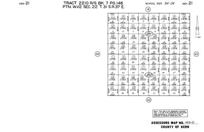
There is not an address associated with this parcel. What is reflected is the Parcel# of 469-211-13-00-3 which is +/- 2.51 AC. Zoning is PL RS MH. Located in the area of Cantil which is Unincorporated Kern County.
- Type:
- Land
- Sq.Ft.:
- n/a
- Status:
- Active
- Beds:
- n/a
- Lot size:
- 2.21 Acres
- Baths:
- MLS#:
- 24002519
ADDITIONAL INFORMATION
2.21 acre residential corner lot at Neuralia & Obsidian in Cantil with paved frontage and mutual water & power. APN 181-160-09. The location is a great staging location for off-road riders heading for the Red Rock trails.
- Type:
- Land
- Sq.Ft.:
- n/a
- Status:
- Active
- Beds:
- n/a
- Lot size:
- 20 Acres
- Baths:
- MLS#:
- DW24069822
ADDITIONAL INFORMATION
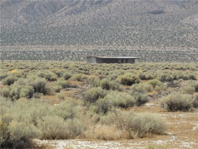
Great Opportunity to own over 20 acres of land with a small cabin that has a 2 bedroom 1 bath with a well. Excellent if you like the outdoors. Don't miss this opportunity.
$105,000
469-100-07-00-7 Cantil, CA 93501
- Type:
- Land
- Sq.Ft.:
- n/a
- Status:
- Active
- Beds:
- n/a
- Lot size:
- 6.62 Acres
- Baths:
- MLS#:
- EV24034830
ADDITIONAL INFORMATION
There is not an address associated with this parcel. What is reflected is the Parcel# 469-100-07-00-7 which is +/-6.62 Acres. Zoning is A(Agricultural). Located in Unincorporated Kern County in the area of Cinco.
$105,000
469-100-07-00-7 Cantil, CA 93501
- Type:
- Land
- Sq.Ft.:
- n/a
- Status:
- Active
- Beds:
- n/a
- Lot size:
- 6.62 Acres
- Baths:
- MLS#:
- CREV24034830
ADDITIONAL INFORMATION
There is not an address associated with this parcel. What is reflected is the Parcel# 469-100-07-00-7 which is +/-6.62 Acres. Zoning is A(Agricultural). Located in Unincorporated Kern County in the area of Cinco.
- Type:
- Land
- Sq.Ft.:
- n/a
- Status:
- Active
- Beds:
- n/a
- Lot size:
- 35 Acres
- Baths:
- MLS#:
- 24000083
ADDITIONAL INFORMATION
For sale: 14 vacant lots, each approximately 2.5 acres, totaling around 35 acres. Priced at an unbeatable $32,000. The property has paved road access and is located next to the Honda Test Facility. A fantastic investment opportunity! Available parcels APN's: 181-331-19, 181-331-20, 181-331-21, 181-331-22, 181-331-26, 181-331-27, 181-331-28, 181-331-29, 181-331-30, 181-331-35, 181-331-36, Joan F. Jones Rev Trust: 181-331-17, 181-332-18, 181-332-24,
- Type:
- Land
- Sq.Ft.:
- n/a
- Status:
- Active
- Beds:
- n/a
- Lot size:
- 10 Acres
- Baths:
- MLS#:
- CRSR23230475
ADDITIONAL INFORMATION
10 acre agricultural lot in the Cantil area north of Mojave and California City, and south of Redrock. APN 469-261-25-00-3.
- Type:
- Land
- Sq.Ft.:
- n/a
- Status:
- Active
- Beds:
- n/a
- Lot size:
- 2.51 Acres
- Baths:
- MLS#:
- CRSR23230438
ADDITIONAL INFORMATION
2.51 acre residential lot in the Cantil area south of Redrock, and north of Mojave/Cal City. APN 469-252-50-00-9.
$94,900
Munsry Rd Cantil, CA 93519
- Type:
- Land
- Sq.Ft.:
- n/a
- Status:
- Active
- Beds:
- n/a
- Lot size:
- 79.86 Acres
- Baths:
- MLS#:
- 23008617
ADDITIONAL INFORMATION
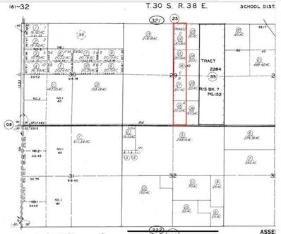
Discover the potential of this pristine 80-acre parcel, subdivided into four 20-acre lots, situated in close proximity to the Honda Proving Center facility. Enjoy the convenience of paved road access, offering ease of transportation to and from this expansive piece of land. Prospective buyers are encouraged to independently verify and ensure satisfaction with regards to access, zoning regulations, utility availability, and permissible land usage. Unleash the possibilities and make your mark on this blank canvas of opportunity. Parcels 181-321-17, 181-321-15, 181-321-14 are included. Seller may sell separately.
$19,900
10313 Lake Road Cantil, CA 93519
- Type:
- Land
- Sq.Ft.:
- n/a
- Status:
- Active
- Beds:
- n/a
- Lot size:
- 5 Acres
- Baths:
- MLS#:
- ND23186331
ADDITIONAL INFORMATION
Five Acres of beautiful flan land. Lake road has recently been repaved. The lot size is 323 x 674. Located eight miles from Red Rock Canyon State Park. Red Rock canyon features beautiful red rock formations. Why drive to Utah when you can visit this stunning national park. Homes nearby. This land has plenty of potential for the development of multifamily or single-family homes. Located between Palmdale and Ridgecrest. Homes nearby, water and electricity nearby also. APN#181-261-27-00-2 GPS COORDINATES 35.317116, -117.944638
- Type:
- Land
- Sq.Ft.:
- n/a
- Status:
- Active
- Beds:
- n/a
- Lot size:
- 54.28 Acres
- Baths:
- MLS#:
- CREV23150204
ADDITIONAL INFORMATION
There is not an address associated with this parcel. What is reflected is the Parcel# 181-340-01-00-2 which is +/-54.28 Acres. Zoning is E(20) RS. Located in Unincorporated Kern County in the Cinco area. Access via dirt Richard Ave. Buyer and Buyers agent are responsible to satisfy themselves in regards to zoning, usage, and utilities.
$55,000
Rodgers Road Cantil, CA 93519
- Type:
- Land
- Sq.Ft.:
- n/a
- Status:
- Active
- Beds:
- n/a
- Lot size:
- 4 Acres
- Baths:
- MLS#:
- CL23263893
ADDITIONAL INFORMATION
4.33 acres. Cantil Area Beautiful Corner lot on two major paved streets. North of California City. Few hundred feet from major Hwy 14. Approx 2.5 miles north of Honda Proving Center of California, 30216 Neuralia Rd Cantil, CA 93519 Located near major solar farms.
- Type:
- Land
- Sq.Ft.:
- n/a
- Status:
- Active
- Beds:
- n/a
- Lot size:
- 2.16 Acres
- Baths:
- MLS#:
- CREV20255808
ADDITIONAL INFORMATION
There is not an address associated with this parcel. What is reflected is the Parcel# 181-374-05-00-1 is +/-2.16 Acres. Zoning is E(2 1/2) R. Located in Unincorporated Kern County in the area of Cinco.
- Type:
- Land
- Sq.Ft.:
- n/a
- Status:
- Active
- Beds:
- n/a
- Lot size:
- 2.16 Acres
- Baths:
- MLS#:
- EV20255808
ADDITIONAL INFORMATION
There is not an address associated with this parcel. What is reflected is the Parcel# 181-374-05-00-1 is +/-2.16 Acres. Zoning is E(2 1/2) R. Located in Unincorporated Kern County in the area of Cinco.


Cantil Real Estate
The median home value in Cantil, CA is $300,000. This is lower than the county median home value of $334,900. The national median home value is $338,100. The average price of homes sold in Cantil, CA is $300,000. Approximately 0% of Cantil homes are owned, compared to 0% rented, while 100% are vacant. Cantil real estate listings include condos, townhomes, and single family homes for sale. Commercial properties are also available. If you see a property you’re interested in, contact a Cantil real estate agent to arrange a tour today!
Cantil, California has a population of 28. The county average for households married with children is 36.03%.
The median household income for the surrounding county is $58,824 compared to the national median of $69,021. The median age of people living in Cantil is 0 years.
Cantil Weather
The average high temperature in July is 101.6 degrees, with an average low temperature in January of 30.4 degrees. The average rainfall is approximately 5.3 inches per year, with 0.5 inches of snow per year.
